Toolset Maps Premium | Display anything as markers on Google Maps 2.2.1
Original price was: $14.99.$3.99Current price is: $3.99.

Types Integration
Both posts and users may utilize the ‘address’ field.
Users can enter addresses more easily with Toolset Maps’ full GUI and auto-complete. The WordPress admin displays this feature, which originates from the Google Maps API.
The coordinates for the chosen address can either be displayed or hidden, and you can modify them by entering new values. Keep in mind that Toolset Maps will always round manually entered coordinates to the nearest address that Google can manage.
Address fields may repeat, allowing a user or post to contain a number of addresses.
The output of the Types integration is fairly simple. With Types, you can show either the location’s latitude and longitude coordinates or the saved address in plain text. You require Views in order to display a full map with a marker.
Integration of CRED
Address fields function quite similarly to these fields in the WordPress admin (by Types) when they are included in CRED forms. Visitors can enter addresses, and a preview of those addresses will appear on the map.
Integration of views
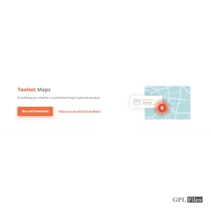
Use Views to display addresses on a map. You can show a Google Map and add markers to it that will show any data from your website.
Wpv-map-render and Wpv-map-marker are two new shortcodes for Views offered by Toolset Maps. They are accessible via the Google Maps portion of the Fields and Views menu.
Without any markers, a Google Map is displayed by “wpv-map-render.”
There are numerous choices available in the dialog to enter a “wpv-map-render” shortcode:
Map ID and size – The ID comes with a pre-loaded special value. You may easily change the default values for width and height.
Zoom and center settings – By default, the map’s center and zoom rely on how many and where in the map’s markers are located, but any of these variables can be overridden.
Marker clustering – You can specify how many and how near markers will be added to each cluster and group markers that are close enough to be displayed as a cluster.
When you double-click, scroll, or drag the map with your mouse, you can choose what happens.
This release introduces clustering
A clustering function was absent from Toolset Maps’ beta releases, but it is present in the current production version. Clustering is an option you have when inserting a map. When enabled, markers that are too close together will be grouped and presented as one marker, or a “cluster,” depending on your preference. Visitors can zoom in on the map and see the specific markers by clicking on the marker.
Related products
-
Sale

WPMU DEV Hustle 7.8.8
Original price was: $14.99.$3.99Current price is: $3.99. -
Sale
Admin Columns Pro Toolset Types 1.8
Original price was: $14.99.$3.99Current price is: $3.99. -
Sale
Toolset Maps 2.0.6
Original price was: $14.99.$3.99Current price is: $3.99. -
Sale
Toolset WooCommerce Views 3.4.2
Original price was: $14.99.$3.99Current price is: $3.99. -
Sale
Toolset Module Manager 1.8.6
Original price was: $14.99.$3.99Current price is: $3.99. -
Sale

Slick Menu - Responsive WordPress Vertical Menu 1.5.6
Original price was: $14.99.$3.99Current price is: $3.99. -
Sale
Toolset Framework Installer 3.1.18
Original price was: $14.99.$3.99Current price is: $3.99. -
Sale

FS Poster GPL - WordPress auto poster & scheduler 7.4.1
Original price was: $14.99.$3.99Current price is: $3.99.